How Much Does Professional Drone Cinematography in Boulder Cost, and What Affects the Price?
8 Views
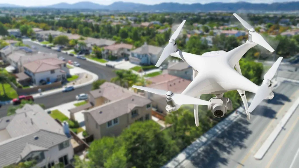
Boulder looks like a movie set. The Flatirons rise out of the foothills, the Front Range stretches north and south, and the creek paths, historic downtown, and university campus all sit within a short drive of each other. For a filmmaker or marketer, that variety is a gift. The hard part is showing it the way people actually experience it, and that is where drone cinematography comes in. At Creative Drone Solutions, we have seen how much a well-planned aerial shot can change the feel of a project. This guide covers what drone cinematography is, why it matters for businesses in Boulder, how the legal and practical details work, and how to get a result you will be proud to publish.
What Is Drone Cinematography, and Why Does It Matter Today?
Drone cinematography is the craft of capturing cinematic video from an unmanned aircraft. It is not simply flying a camera up and filming whatever is below. A skilled operator providing Drone Cinematography in Boulder plans shot sequences, controls speed and camera angle, works with natural light, and thinks about how each clip will cut together in the final edit. A few years ago, this kind of footage required a helicopter, a crew, and a large budget.
Drones changed that. Small, stable aircraft with high-quality gimbals and sensors now produce smooth, sweeping footage at a fraction of the cost, and they can safely fly in places a helicopter cannot. It matters for businesses because video dominates how people discover and evaluate products, properties, and places. A viewer who scrolls past a static photo will often stop for a slow reveal of a building rising into frame or a smooth push-in toward a mountain backdrop. Aerial footage also communicates scale, location, and context in seconds, which is hard to do with ground-level shots alone.
Core Techniques in Aerial Filmmaking
Professional drone cinematography relies on a handful of movements, each creating a different feel:
-
Reveal shots: The drone rises or moves sideways to uncover a subject gradually, such as a home emerging from behind a line of trees.
-
Orbit shots: The aircraft circles a subject, giving it dimension and a sense of importance.
-
Tracking shots: The drone follows a moving subject like a cyclist, a vehicle, or a runner on a trail.
-
Push-ins and pull-outs: A slow approach builds focus, while a pull-out reveals the surrounding landscape.
-
Top-down shots: Looking straight down shows layout, patterns, and geography.
The skill is in choosing the right move for the story, then executing it smoothly.
Why Boulder Is Such a Strong Setting for Aerial Video
Every city has its own visual identity, and Boulder's is unusually strong. Here is what makes it compelling from above:
-
Dramatic terrain: The foothills meet the plains abruptly, so a single frame can include rock formations, neighborhoods, and open sky.
-
Four distinct seasons: Golden aspens, snowy ridgelines, green spring hillsides, and summer storm clouds give the same location a different look throughout the year.
-
Strong architecture and character: Historic buildings, modern developments, and university grounds provide variety for commercial and lifestyle content.
-
An active, outdoor-focused culture: Cycling, climbing, trail running, and ski-adjacent brands all benefit from footage that captures movement in landscape.
Even so, Boulder is not an easy place to fly. Elevation, fast-changing weather, and land-use rules all shape how a shoot is planned. We cover those below.
Who Benefits From Drone Cinematography in Boulder?
Aerial video is not only for filmmakers. Many local organizations use it to tell their story better.
-
Real estate professionals and developers. Aerial footage shows lot size, neighborhood context, mountain views, and proximity to trails or downtown, all things buyers care about.
-
Hospitality and tourism businesses. Hotels, event venues, and tour companies can use aerial video to show what makes a location special.
-
Outdoor, sports, and lifestyle brands. Brands tied to movement and landscape get more from a sweeping tracking shot than from a static product image.
-
Construction and commercial developers. Progress footage documents a project over time and gives stakeholders a clear picture of how work is advancing.
-
Universities, nonprofits, and event organizers. Campus tours, fundraising videos, and festival recaps all gain scale and energy from aerial perspectives.
-
Filmmakers and agencies. Production companies often bring in specialized drone crews to add aerial coverage to larger projects.
Real Estate Aerial Videography in Boulder
Among all the uses of drone cinematography, real estate is one of the most practical. Boulder's housing market rewards presentation, and Real Estate Aerial Videography in Boulder can highlight setting and views that buyers often care about as much as square footage.
What Aerial Videography Adds to a Listing
Interior photography shows a home. Aerial video shows where the home lives. A well-made listing video can communicate:
-
The size and shape of the lot and any outdoor living space
-
How close the property sits to trails, open space, schools, or downtown
-
The orientation of the home, which affects views and natural light
-
The character of the surrounding neighborhood
-
Unique features, such as mountain views, that are hard to convey from the ground
Best Practices for Real Estate Aerial Video
-
Open with context, then move in close. A strong sequence often begins with a wide view of the area and gradually narrows to the property, mimicking how a buyer would approach in person.
-
Shoot in the right light. Early morning and late afternoon provide softer, warmer light and reduce harsh shadows. Midday sun flattens texture and can make roofs and driveways look stark.
-
Keep movements smooth and unhurried. Fast or jerky motion feels cheap. Slow, steady camera work feels confident and premium.
-
Combine aerial with ground footage. The best listing videos blend drone shots with interior and exterior ground-level clips, so the viewer gets both perspective and detail.
-
Think about timing and season. A property with mature landscaping may look best in fall color or summer green. Plan shoots for when the home and its surroundings look their best, and avoid heavy haze or smoke when possible.
-
Keep it concise. Most viewers lose interest in long real estate videos. A tightly edited piece usually outperforms a lengthy one.
A Quick Example
Imagine a home on the edge of a neighborhood backing onto open space. A street-level photo shows a nice house. An aerial sequence, however, can begin over the trailhead, drift toward the home, and pull back to reveal the foothills behind it. That single shot answers the question buyers are really asking: what is it like to live here?
Property Drone Photography in Boulder
Video gets the attention, but Property Drone Photography in Boulder remains valuable for listings, brochures, websites, and print materials.
Why Still Aerial Images Matter
-
They work everywhere. Photos fit MLS listings, social posts, printed flyers, and property websites without extra formatting.
-
They highlight boundaries and layout. An overhead image makes lot lines, access roads, and outbuildings easy to understand.
-
They support commercial and land sales. For larger parcels, aerial stills help buyers grasp acreage, terrain, and surrounding land use.
-
They capture decisive moments. A perfectly lit, well-composed still can become the hero image for an entire marketing campaign.
Tips for Stronger Property Photography
-
Choose the right altitude. Too high and the property shrinks. Too low and you lose the context that makes aerial worthwhile.
-
Clean up the scene first. Trash bins, stray vehicles, and clutter look far more obvious from above.
-
Shoot multiple angles. Capture the front, the sides, and a few oblique angles that show how the property relates to its surroundings.
-
Use bracketed exposures when needed. Bright skies and shaded ground are hard to balance in a single frame.
-
Edit with restraint. Natural color and accurate representation build trust. Over-edited images set unrealistic expectations and hurt credibility.
Legal and Safety Considerations in Boulder
Responsible aerial work means knowing the rules. Cutting corners here can lead to fines, grounded shoots, or worse. Regulations change, so always confirm current requirements with the FAA and local authorities before flying.
FAA certification. In the United States, flying a drone for business purposes generally requires a Remote Pilot Certificate under FAA Part 107. Hiring a certified pilot protects you from compliance problems.
Airspace authorization. Boulder sits near controlled airspace in parts of the Front Range. Depending on the location, a pilot may need FAA authorization before flying. Checking airspace is part of every professional pre-flight routine.
Remote ID and registration. Drones used commercially must be registered with the FAA and comply with current Remote ID requirements.
Local and land-management rules. Launching or landing from certain city, open space, and park properties is restricted or prohibited, and national park lands have their own strict limits. A local operator will know which locations need permits and which are off limits.
Privacy and property permission. Even where flying is legal, good practice means getting permission from property owners, notifying neighbors when appropriate, and avoiding filming people in private spaces.
Insurance. Reputable operators carry liability insurance. Ask for proof before hiring.
Weather, Wind, and Elevation
Boulder's setting creates real flying challenges. Wind can pick up quickly near the foothills, afternoon thunderstorms can build fast in summer, and cold temperatures affect battery performance in winter. Thinner air at elevation also reduces aircraft efficiency. Experienced local pilots build buffer time into schedules and will reschedule rather than fly in unsafe or unflattering conditions. That is a sign of professionalism, not unreliability.
How a Professional Drone Cinematography Project Works
Understanding the process helps you plan and budget well. A typical project looks like this:
-
Discovery and goals. We start by learning what the footage needs to do, whether that is selling a home, promoting an event, or documenting construction.
-
Planning and scouting. This includes shot lists, location research, airspace checks, and permission requests.
-
Scheduling around light and weather. The best shoots are timed carefully and stay flexible.
-
Filming. A pilot and, for complex jobs, a separate camera operator or spotter capture the planned shots along with extra coverage.
-
Editing and color grading. Footage is cut, graded, paced, and often paired with music, titles, or voiceover.
-
Delivery. Files are formatted for the platforms where they will be used, from websites and MLS systems to social media.
What Affects the Cost of Drone Cinematography in Boulder?
Pricing varies widely, and the cheapest option is rarely the best value. Key factors include:
-
Scope and length: A short listing video costs less than a multi-day brand production.
-
Crew size and equipment: Complex shots may need additional operators or specialized cameras.
-
Location and access: Remote or restricted sites take more planning.
-
Editing needs: Custom graphics, motion design, and professional sound add time.
-
Usage rights: Broad commercial licensing can affect pricing.
-
Turnaround time: Rush requests typically cost more.
Ask for a written quote that spells out what is included, so you can compare providers fairly.
How to Choose the Right Drone Cinematographer
When evaluating providers, look for:
-
A current FAA Part 107 certificate and proof of insurance
-
A strong, relevant portfolio that matches your type of project
-
Local knowledge of Boulder's terrain, weather patterns, and regulations
-
Editing ability, since great footage still needs skilled post-production
-
Clear communication about timelines, revisions, and deliverables
-
Reliable backup equipment and a plan for weather delays
Creative Drone Solutions can be evaluated based on these factors. Watch a few complete sample videos rather than a highlight reel. Consistent smoothness, composition, and storytelling across projects is the best indicator of quality.
Getting the Most From Your Footage
The work does not end at delivery. To get the best return:
-
Repurpose content. A single shoot can yield a full video, short social clips, and still images.
-
Optimize for each platform. Vertical cuts suit mobile social feeds, while widescreen suits websites and presentations.
-
Add context. Captions, location details, and descriptive file names and alt text help both viewers and search engines understand your content.
-
Refresh seasonally. Updating aerial content once or twice a year keeps your marketing current.
Conclusion
Boulder's landscape is one of its greatest marketing assets, and aerial visuals are the clearest way to show it off. Whether you are launching a brand campaign, documenting a development, or listing a home, drone cinematography gives viewers the scale, context, and emotion that ground-level footage cannot match. Real estate aerial videography helps buyers picture the lifestyle around a property, and property drone photography provides the clear, versatile images every listing needs. Combined with careful planning, legal compliance, and skilled editing, they make a powerful pair.
FAQs
Do I need a licensed pilot for property drone photography in Boulder?
If the images are used for business purposes, such as marketing a listing, the FAA generally requires a Part 107 Remote Pilot Certificate. Hiring a certified pilot keeps your project compliant.
Can drone photos be taken of any property in Boulder?
Not always. Airspace rules, local regulations, and property owner permission all matter. A professional will check these before flying.
How long does a property drone photo shoot take?
Most residential shoots take about 30 to 60 minutes on site, depending on property size and the number of angles required. Weather and light can affect scheduling.
What is the best time of day for aerial property photos?
Early morning and late afternoon usually offer the softest, most flattering light. Overcast days can also work well by reducing harsh shadows.
Should I choose aerial photos, video, or both?
Photos are versatile and work across listings and print. Video conveys flow and neighborhood context. Many sellers choose both for maximum impact.