Detailed Atlas Mountains Map for Travelers and Hikers
By addison jons
74 Views
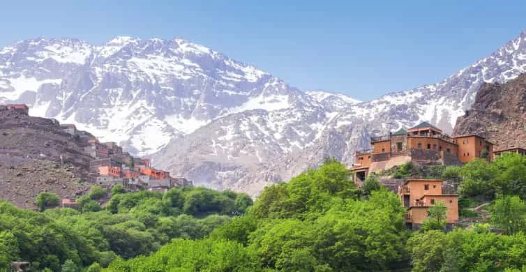
Planning a mountain trip in Morocco is much easier when you understand the terrain before leaving. A good atlas mountains map can help travelers see where major peaks, valleys, villages, roads, and hiking routes are located. Whether you are visiting for a short trek or preparing for a multi-day hiking adventure, having a clear map gives you a better idea of distances and travel times.
The Atlas range stretches across Morocco and includes several different mountain areas. Each section has its own scenery, elevation, villages, and hiking opportunities. For travelers, knowing how these areas connect can make planning much simpler.
Understanding the Atlas Mountain Regions
The Moroccan mountains are generally divided into three major ranges: the High Atlas, Middle Atlas, and Anti-Atlas. The High Atlas is the most popular area for serious hikers because it contains some of the country's highest peaks.
The Middle Atlas is known for forests, lakes, green valleys, and traditional villages. It offers a different experience from the rocky High Atlas. The Anti-Atlas, located farther south, has dry landscapes, unusual rock formations, and quieter trails.
When studying an atlas mountains map, look at these three regions separately. This makes it easier to understand the distances between destinations and choose the area that matches your travel plans.
High Atlas: The Main Hiking Area
The High Atlas attracts many hikers because of its dramatic peaks and deep valleys. Mount Toubkal is the best-known summit and reaches approximately 4,167 meters above sea level. The village of Imlil is one of the main starting points for treks toward Toubkal.
An atlas mountains map showing the High Atlas can help you identify Imlil, Toubkal, mountain passes, valleys, and nearby settlements. This is useful when planning accommodation before and after a trek.
Popular places include Aroumd, Imlil, Ouirgane, and several Berber villages scattered throughout the valleys. Some trails connect villages directly, while others climb toward high passes and remote mountain areas.
For first-time hikers, it is usually better to begin with a shorter route. This allows you to become familiar with the altitude, terrain, and local walking conditions.
Using a Map Before Your Trip
Before starting your journey, spend some time studying an atlas mountains map and marking the locations you want to visit. Start with your arrival city, such as Marrakech, and then identify the mountain destination.
For example, travelers heading toward Imlil can follow the road south from Marrakech before entering the mountain valleys. If you are planning to visit the Dades Valley, Aït Benhaddou, or other southern destinations, your route may cross or pass around different sections of the range.
A map can also help you estimate how much time you need between locations. Mountain roads can be slower than highways because of bends, elevation changes, weather, and road conditions.
Hiking Routes and Trail Planning
A detailed atlas mountains map should show more than major cities and roads. Hikers should look for contour lines, elevation information, rivers, mountain passes, villages, and marked trails.
Contour lines are particularly useful because they show changes in elevation. Lines positioned close together usually indicate a steep section, while wider spacing often means gentler terrain.
This information can help you judge whether a trail is suitable for your fitness level. A route may appear short on a map but become difficult because of steep climbs.
For longer hikes, mark possible overnight locations. Mountain villages and refuges can be important stopping points, especially on routes involving Toubkal or other high-altitude areas.
Important Villages for Travelers
Villages are an important part of mountain travel. They provide access to food, accommodation, guides, transportation, and local information.
Imlil is particularly important for Toubkal trekkers. It has become a popular base for hikers and offers guesthouses and trekking services.
Other villages provide access to quieter valleys where travelers can experience rural Moroccan life. When using a map, look for roads leading into valleys rather than focusing only on large towns.
The location of a village can also help you decide where to begin or end a walking route. Some trails can be arranged as day hikes, while others work better as point-to-point journeys.
Roads, Transportation, and Driving
Travelers who plan to rent a vehicle should pay close attention to roads on their map. Mountain roads may be narrow and winding, and driving times can change depending on conditions.
An atlas mountains map can help identify main highways, smaller mountain roads, and alternative routes. However, printed maps should not be your only source of information. Check current road conditions before setting out, especially during winter or after heavy rain.
If you are not comfortable driving mountain roads, hiring a local driver can make the journey easier. Public transportation and shared taxis are also available in many areas, although schedules may vary.
Weather and Seasonal Considerations
Mountain weather can change quickly. Conditions at lower elevations may be warm while higher peaks remain cold.
Spring can bring green valleys and flowers, while summer is often popular for high-altitude trekking. Autumn offers cooler temperatures and pleasant walking conditions in many areas. Winter can bring snow to higher elevations, making some routes more demanding.
Use your atlas mountains map together with a current weather forecast when planning a hike. A map tells you where you are going, but weather information helps you decide whether it is safe and practical to travel that day.
What Hikers Should Mark on Their Maps
Before leaving, mark several important points on your map. These can include your accommodation, trailhead, water sources, villages, emergency access roads, mountain refuges, and planned rest points.
Digital maps can be useful because many hiking applications provide GPS tracking and elevation information. Still, carrying a physical map is a sensible backup in areas where phone signals may disappear.
A compass can also be helpful for experienced hikers. Batteries can run out, phones can become damaged, and GPS devices are not perfect.
Safety Tips for Mountain Travelers
Preparation is essential when hiking in remote areas. Tell someone about your planned route and expected return time. Carry enough water, food, warm clothing, sun protection, and basic first-aid supplies.
Do not assume that every trail will be clearly marked. Local guides can provide valuable information about routes, weather, villages, and seasonal conditions.
Altitude is another factor to consider. If you are traveling from a low elevation to a high mountain area, give your body time to adjust. Take breaks and avoid pushing yourself if you feel unwell.
Choosing the Right Map
There is no single perfect map for every traveler. Casual tourists may only need a basic road map showing towns and major attractions. Serious hikers should choose a topographic map with elevation details and walking trails.
A reliable atlas mountains map should be easy to read, detailed enough for your route, and preferably updated. Digital mapping tools are useful for navigation, while printed maps are valuable as backup material.
If you are planning a multi-day trek, consider using both. Download maps to your phone before leaving areas with reliable internet access, and keep a physical copy with your hiking equipment.
Final Thoughts
A well-prepared journey through the Moroccan mountains starts with understanding the geography. The right atlas mountains map allows travelers to see how villages, roads, valleys, peaks, and hiking routes fit together.
The atlas mountains offer experiences for many types of travelers, from relaxed valley walks to demanding high-altitude climbs. Spend time researching your route, check seasonal weather, prepare suitable equipment, and allow extra time for mountain travel.
With careful planning and a reliable map, hikers can enjoy the scenery with greater confidence while discovering villages, dramatic peaks, and quiet valleys along the way. The atlas mountains are best explored at a comfortable pace, giving travelers enough time to appreciate both the natural environment and the local communities that call these mountains home.