Atlas Mountains Map: From the High Atlas to the Anti-Atlas
By andy smaith
10 Views
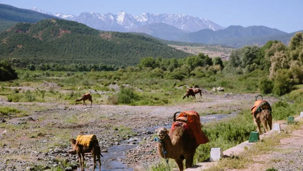
The Atlas Mountains form one of North Africa’s most impressive mountain systems, stretching across Morocco, Algeria, and Tunisia. They create a dramatic geographical transition between the Mediterranean coast, the Sahara Desert, and the fertile plains of the Maghreb.
Understanding an Atlas Mountains map is an excellent way to see how the different ranges connect and why the landscape changes so dramatically from north to south.
From the towering peaks of the High Atlas to the rugged valleys of the Anti-Atlas, each section has its own geography, climate, communities, and natural attractions. For travelers, hikers, photographers, and geography enthusiasts, learning about these ranges provides a clearer picture of one of Africa’s most fascinating mountain regions.
Understanding the Atlas Mountain System
The Atlas Mountains are not a single continuous ridge. Instead, they consist of several interconnected ranges with different elevations and geological characteristics. In Morocco, the major sections include the High Atlas, Middle Atlas, Anti-Atlas, and areas associated with the broader Atlas system.
The mountains generally run from southwest toward northeast. Their position has influenced settlement, agriculture, transportation, and climate for thousands of years. Rivers flowing from the mountains provide water for valleys and plains, while high elevations create environments that are very different from the surrounding dry regions.
A detailed Atlas Mountains map helps distinguish these ranges and understand their relative positions. It also shows how mountain passes, valleys, villages, and major peaks are distributed across Morocco and the wider North African landscape.
The High Atlas
The High Atlas is the highest and most spectacular part of the Moroccan Atlas system. It stretches across central Morocco and contains the country’s tallest peaks. Mount Toubkal, rising to approximately 4,167 meters, is the highest mountain in Morocco and North Africa.
The High Atlas is characterized by steep valleys, rocky ridges, alpine environments, and traditional Berber communities. During winter, higher elevations can receive substantial snowfall, while summers are generally dry and warm.
Popular areas around the High Atlas include Imlil, Aït Bouguemez, Oukaimeden, and the Toubkal region. Hiking routes range from relatively easy valley walks to demanding high-altitude treks.
For travelers planning an expedition, studying an Atlas Mountains map can help identify mountain passes, trail locations, nearby settlements, and connections between different valleys.
The Middle Atlas
Located north of the High Atlas, the Middle Atlas has a noticeably different appearance. Its landscapes include forests, plateaus, volcanic formations, springs, and green valleys. Cedar forests are particularly important to the region and provide habitat for Barbary macaques and many bird species.
The Middle Atlas is generally less rugged than the High Atlas, although it still contains substantial elevations. Towns such as Ifrane and Azrou are important destinations in the region. Ifrane is famous for its cool climate, European-style architecture, and nearby mountain landscapes.
The Middle Atlas also plays an important role in Morocco’s water resources. Numerous rivers and springs originate in or pass through this region before supplying surrounding agricultural areas.
The Anti-Atlas
Farther south lies the Anti-Atlas, an ancient and geologically fascinating mountain range. It extends through southern Morocco and forms an important transition between the High Atlas and the Sahara.
Unlike the snow-covered summits sometimes associated with the High Atlas, the Anti-Atlas is known for dry valleys, rocky plateaus, dramatic cliffs, and desert-like scenery. The region is especially attractive to visitors interested in geology, traditional villages, photography, and quieter trekking experiences.
Places such as Tafraoute are well known for their striking granite formations and colorful landscapes. The Anti-Atlas also contains oases and valleys where agriculture is possible because of local water sources.
When examining an Atlas Mountains, the Anti-Atlas can be identified farther south than the main High Atlas chain. Its location explains why the scenery gradually becomes drier as travelers move toward the Sahara.
Major Peaks and Mountain Passes
The Atlas region contains numerous important peaks and passes. Mount Toubkal is the best known, but it is only one part of a much larger mountain environment.
Mountain passes have historically served as routes connecting isolated valleys and settlements. Today, some are important roads, while others remain primarily trekking routes. The Tizi n'Tichka pass, for example, connects Marrakech with the Ouarzazate area and crosses the High Atlas.
Other mountain routes provide access to remote villages, agricultural terraces, valleys, and scenic viewpoints. Travelers can use geographical maps to understand elevation changes before choosing an itinerary.
Landscapes Across the Atlas
One of the most remarkable features of the Atlas region is its variety. A journey across the mountains can involve completely different environments within a relatively short distance.
The High Atlas contains snow-capped peaks, alpine valleys, and rugged cliffs. The Middle Atlas has extensive forests, lakes, and green plateaus. The Anti-Atlas features dry mountains, unusual rock formations, and desert-edge landscapes.
This diversity is influenced by elevation, rainfall, geology, and distance from the Atlantic Ocean and Mediterranean Sea. The mountains also create local microclimates, meaning conditions can differ significantly between neighboring valleys.
Atlas Mountains and Local Communities
Mountain geography is closely connected to the people who live in the region. Amazigh communities have inhabited many Atlas valleys for generations, developing distinctive architecture, farming methods, crafts, languages, and cultural traditions.
Terraced agriculture is common in some mountain valleys, allowing communities to cultivate land on steep slopes. Crops may include barley, wheat, olives, almonds, walnuts, and various fruits depending on elevation and available water.
Traditional mud-brick and stone villages often blend naturally into the surrounding landscape. Visitors exploring the mountains can experience local hospitality while learning about customs that have developed alongside the challenging mountain environment.
Using a Map for Trekking and Travel
A reliable map is particularly useful for anyone planning to explore the Atlas Mountains. It can help identify distances, elevations, roads, trails, villages, rivers, and mountain passes.
Hikers should pay close attention to elevation because a route that appears short on a map can become physically demanding when it involves steep climbs. Weather can also change quickly at higher elevations, particularly in the High Atlas.
An Atlas Mountains is therefore more than a geographical reference. It can become an essential planning tool for selecting routes, estimating travel times, identifying alternative paths, and understanding the relationship between major attractions.
Best Time to Explore Different Ranges
The ideal season depends on the part of the Atlas Mountains being visited. Spring and autumn are often comfortable for hiking in many areas because temperatures are generally moderate.
Summer can be hot at lower elevations, although higher mountain areas may remain pleasant. Winter brings snow to the High Atlas and can make some high-altitude routes difficult or inaccessible.
The Anti-Atlas can be particularly appealing during cooler months because summer temperatures can become extremely high. Checking local weather and trail conditions before traveling is always recommended.
Explore the Atlas With mttoubkaltrek
For travelers interested in discovering Morocco’s mountain landscapes, mttoubkaltrek can be a useful resource for experiencing the Atlas region through guided adventures and trekking experiences. Exploring the mountains with knowledgeable local support can make it easier to understand the geography, culture, trails, and communities encountered along the way.
Whether the goal is a challenging High Atlas trek, a scenic valley excursion, or an exploration of the Anti-Atlas, careful planning can turn a mountain journey into a memorable experience.
Conclusion
From the spectacular peaks of the High Atlas to the ancient rocky landscapes of the Anti-Atlas, Morocco’s mountain regions offer extraordinary geographical and cultural diversity. The Middle Atlas adds forests, plateaus, and refreshing valleys, creating another distinct environment within the wider system.
Studying an Atlas Mountains map makes it easier to understand how these ranges are connected and how elevation and location influence their landscapes. Whether you are interested in hiking, photography, geography, or cultural exploration, the Atlas Mountains provide countless opportunities to discover North Africa from a unique perspective.